-40%
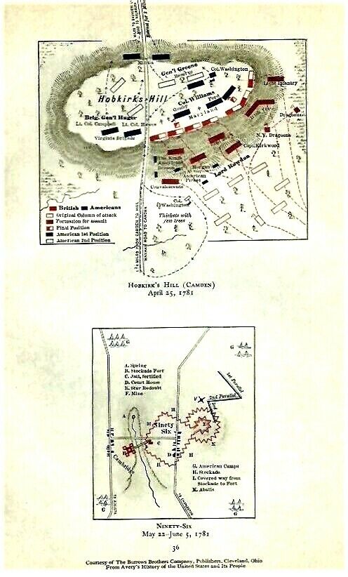
Vintage 1781 Revolutionary War Maps HOBKIRK'S HILL (CAMDEN) & NINETY-SIX
$ 5.14
- Description
- Size Guide
Description
Maps areORIGINAL
as published in 1911 and
NOT
photocopies.
This page shows 2 maps, one titled
HOBKIRK'S HILL (CAMDEN) April 25, 1781
, and the 2nd titled
NINETY - SIX May 22 - June 5, 1781
.
Page accompanied a publication titled "The Revolutionary War and the Military Policy of the United States" which was published in 1911.
Names I see on map include Cambridge, Brig. Gen. Huger, Lord Rawdon, N.Y. Dragons, Irish Vol., The King's Americans, Virginia Brigade, Morgan, Picket, Col. Washington, Gen'l Greene, Road to Salisbury, Waxhaw Road to Camden,
and more.
Page measures approx 5 3/4" by 8 5/8", pair of maps together approx 3 3/4" by 6 3/4" with blank back on lightweight paper. It is in excellent condition.
MAP IS MUCH SHARPER AND CLEARER IN REAL LIFE THAN IT IS IN MY BLURRY SCAN.
Satisfaction guaranteed, successful bidder to
prepay and include .50 for 1st class S & H in the US without a tracking number.
Thank you!
Multiple similar items may be combined for a reduction in postage.
.
Track Page Views With
Auctiva's FREE Counter
Track Page Views With
Auctiva's FREE Counter


